

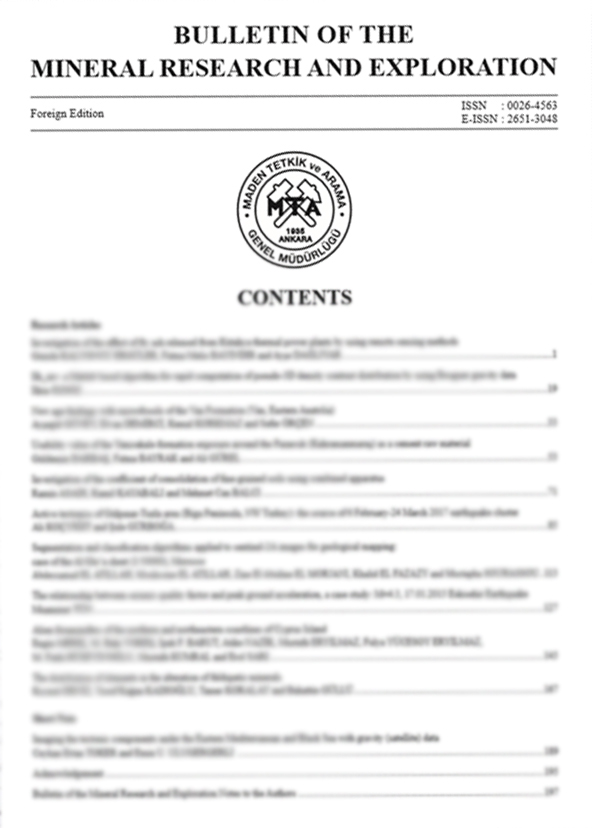
Volume 165 · 2021 · 15 ARTICLES
All Articles In This Issue
01
Indexed In · Volume 165 / 2021
Metallogenic characteristics of some localities of gold mineralization along shear zones of Elgaab, Dum el Tor and Sodri - Um Bader, (Sudan)
Authors: ABSTRACTStudy area is located in the eastern sector of Saharan Meta - Craton that includes the western part of Bayuda Terrane and extend southwest to Sodri - Um Badir shear zones. The sector is dominated by metasediments, metavolcanic - sedimentary series represented by chlorite - schist, quartzite, calc - silicate, and marble. Low - grade metamorphic arc - related volcano - sedimentary sequence occurs as thin narrow bands and subjected to tectono - thermal events of Pan - African orogeny during the Late - Proterozoic era (900 - 550 Ma). All these rock sequences have been intruded by syn to Late Orogenic Granitoids and post - orogenic ring - shaped complex and felsic dykes. The intrusions are thought to be the source of hydrothermal fluids that caused the precipitation of gold. Similar characteristics of geological features and tectonic settings support the possibility of the extension of gold mineralization between shear zones. The comparison between the three gold mineralizations reveals variations in minerals assemblages, pathfinders and gold grade. The result of this study defines a new metallogenic province in the west of the River Nile, which occupies a very large area covered by Phanerozoic sediments. Numerous mineral deposits of economic potentiality have been targeted along the shear zones and related fractures and faults. Among those potential deposits, five of them have been chosen as targets for future gold exploration and evaluation.
https://doi.org/10.19111/bulletinofmre.695138
Keywords:
02
Indexed In · Volume 165 / 2021
Evaluation of thermomagnetic properties and geothermal energy potential in parts of Bida Basin, Nigeria, using spectral analysis
Authors: ABSTRACTThermomagnetic properties and geothermal energy potential in parts of Bida Basin, Nigeria have been evaluated using spectral analysis of integrated nine aeromagnetic data. The study area covering 27.225 km2 of aeromagnetic data was examined and construed in order to delineate the thermal properties of the country-rock in the area. The result of the visual inception of the residual map reveals that the area comprises an extremely irregular pattern of magnetic intensities that range from 220 to 240 nT. Two structural features of folding evidence were also delineated in the area namely; uplift and depression. The result of the lineament structures from the shaded relief map and Rose diagram depicts NE-SW as the major trend with the minor trend is NW - SE. Two depths to magnetic sources were distinguished in the area: the shallower bodies which vary from 1.27 to 1.96 km and the deeper bodies that vary from 2.01 to 4.27 km. The result also shows an average depth to the centroid as 12.97 km in the area. The thermomagnetic properties analysis show average values of 23.12 km Curie isotherm, 25.27 °C/km geothermal gradients and 63.17 mWm2 heat flow in the area. The study concludes that the study area possesses good potential quality for geothermal energy generation and exploration.
https://doi.org/10.19111/bulletinofmre.695138
Keywords:
03
Indexed In · Volume 165 / 2021
Geological properties of Güney formation (Ereğli - Ulukışla Basin, Niğde)
Authors: ABSTRACTThe aim of this study to determine stratigraphic, sedimentological and petrographic characteristics of the Upper Paleocene - Lower Eocene Güney formation in the Ereğli - Ulukışla Basin based on the lithological and environmental interpretations related to petroleum source and reservoir rock properties of it. For this purpose, the geological characteristics of the Güney formation and its relations with other units were followed by field observations and the unit was investigated by making a stratigraphic cross section from bottom to top. In addition, during the field studies, four (4) scaled stratigraphic sections (OSK) were formed and fifty - two (52) sandstone samples were taken from these OSKs. The Güney formation starts with conglomerates at the basement and continues as sandstone - shale alternation. The fact that the sand size material is more than the clay size material, the sandstone layers are thick (at least 2 m) around the Kardeşgediği station, the presence of channel fillings, slump structures, and pebbles indicate that the sequence shows convergent turbidite character. However, in the vicinity of Ovacık - Güney village and Tatlıpınar ridges, shales having an average layer thickness of 30 cm (thick) and sandstones up to 3 - 5 cm (thin) and shales are denser than sandstones show the formation has divergent character. The Güney formation transitions laterally and vertically overlies the agglomerate unit of the Ulukışla formation and turbiditic sandstone - shale units of the Halkapınar formation. The Aktoprak formation passes laterally and vertically over the Formation. Petrographic studies show that the formation sandstones are lithic arenite and feldspathic arenite and are deposited in the fore - arc basin.
https://doi.org/10.19111/bulletinofmre.855696
Keywords:
04
Indexed In · Volume 165 / 2021
Comparison of different approaches of computing the tilt angle of the total horizontal gradient and tilt angle of the analytic signal amplitude for detecting source edges
Authors: ABSTRACTThis paper compares effectiveness of the different approaches of computing the tilt angle of the horizontal gradient amplitude and tilt angle of the analytic signal amplitude such as use of direct expression and frequency domain technique (also called k - function) in terms of their accuracy on the detection of the edges of magnetic and gravity sources. These approaches were performed on both synthetic magnetic and gravity data where the frequency domain technique shows improvements in delineation of the actual edges of the sources compared to the direct expression. Additionally, real magnetic data from Zhurihe (Northeast China), and real gravity data from Tuan Giao (Northwest Vietnam) was considered and the obtained results from applying the different approaches were compared with known geological structures. The results show that the boundaries detected from the use of the frequency domain technique are in accord with the known geological structures.
https://doi.org/10.19111/bulletinofmre.746858
Keywords:
05
Indexed In · Volume 165 / 2021
Genesis of the Zebra dolomites and relation to carbonate - hosted Au - Ag - Zn ± Pb deposits in the Maden Village (Ulukışla - Niğde), Central Taurides, South Turkey
Authors: ABSTRACTZebra dolomites and carbonate - hosted Au - Ag - Zn ± Pb deposits of Maden Village is located in the shelf type carbonate rocks of the Bolkar Mountains. The Zebra dolomite locally form and there is no evidence for relation between dolomitization and mineralization. Maden village ZD is characterized by parallel light and dark bands that have similar mineralogy and chemistry by petrographic and SEM + EDX investigation. The δ13C (V - PDB) composition of the Zebra dolomite from 2.59‰ to 2.72‰ and the δ18O (V - PDB) values of the Zebra dolomite from -11.39 ‰ to -14.88 ‰. These isotopic values show that the source of oxygen and carbon was derived from marine carbonates and freshwater carbonates. Fluid inclusion studies on Zebra dolomite show homogenization temperatures of 80 °C - 180 °C. Based on petrographic, isotope values and fluid inclusion study, we can say that the dolomitization occurred during the late diagentic conditions prior mineralization.
https://doi.org/10.19111/bulletinofmre.877977
Keywords:
06
Indexed In · Volume 165 / 2021
Geological and geochemical characteristics of Cünür volcanogenic massive sulfide mineralization (Kastamonu, Turkey)
Authors: ABSTRACTÇangaldağ Metamorphic Complex (CMC) in Central Pontides is an accretionary complex consisting of Jurassic units. Mafic, felsic metavolcanics, metamorphic equivalents of deep marine sediments and mafic meta-lava/sill intercalations are the most distinct units of the complex. Cünür Volcanogenic Massive Sulphide (VMS) mineralization is associated with metavolcanic units of CMC. Metavolcanic units in the mineralization area contain volcanic rocks with compositions ranging from sub-alkali basalt to andesite and dacite (50.3 - 74.6 % SiO2). For 0.1 % Cu cut-off grade, 3,372,000 tons (t) of mineral resource with 0.28 % Cu, 0.50 % Zn and 0.19 ppm Au has been estimated. Ore paragenesis of the Cünür mineralization predominantly consists of pyrite, chalcopyrite and sphalerite, and lesser amounts of magnetite. The main ore textures are massive, semi-massive, disseminated, brecciated and fracture fillings. Pyrite-chalcopyrite grading and preserved silicified clasts within the massive ore indicate that mineralization has developed in relation to replacement processes. The most significant grade intercepts reported for the mineralization are 9 %, 9 %, 0.3
%, 3300 ppb and 79 ppm for Cu, Zn, Pb, Au, Ag, respectively. Cünür mineralization has similarities to bimodal-mafic (Noranda type) Cu-Zn dominated VMS deposits.
https://doi.org/10.19111/bulletinofmre.820436
Keywords:
07
Indexed In · Volume 165 / 2021
The effect of structural properties of Ankara clay on the electrokinetic properties
Authors: ABSTRACTThe aim of this study is to investigate the effect of structural properties of soil known as Ankara clay, which contains different properties, on its electrokinetic behavior. For this purpose, the 8 disturbed samples from Ankara clay were collected from the different locations of Yüzüncüyıl and Karakusunlar areas, which were observed to contain no excess gravel and carbonate concretions. The electrokinetic behavior of these collected samples were evaluated by using the results of plastic limit, liquid limit, methylene blue, swelling, XRD, XRF, SEM, EDS and BET measurements and analyses as well as zeta potential tests. By these experimental studies, it has been determined that Ankara clay exhibits electrokinetic behavior in line with the whole rock composition since it contains different clay minerals. The monovalent and divalent electrolytes such as NaCl and CaCl2, respectively, increase the zeta potential of Ankara clay negatively. However, in the analyses, it was determined that FeCl3 trivalent electrolyte is the electrolytes determining the zeta potential, tend to convert zeta potential of clays from negative to positive depending on the concentration, and this could be the case with increased concentration.
https://doi.org/10.19111/bulletinofmre.770990
Keywords:
08
Indexed In · Volume 165 / 2021
Geochemistry of Miocene evaporites from the Aşkale (Erzurum, Eastern Turkey) area: constraints for paleo-environment
Authors: ABSTRACTThe Aşkale sub-basin hosts Early Miocene evaporites intercalated with clastic sediments and carbonates. Gypsum- and anhydrite-rich evaporite samples are characterized by high CaO and SO4 contents, and low Na2O, K2O, MgO, and B contents. The Sr contents are 228 - 13,100 ppm in evaporite samples, 169 - 992 ppm in claystone, 181 - 60,090 ppm in marl, and 15,150 ppm in limestone. All the samples are also characterized by enrichment in light rare earth elements (REE) with LaN / LuN = 0.667 - 4.243 and have variable CeN / Ce* (0.823 - 1.353) ratios. Measured EuN / Eu* values of the samples display strong and variable negative and positive Eu anomalies. δ34SCDT and δ18O values of gypsum- and anhydrite samples have wide ranges from 21.30 ‰ to 25.62 ‰, and 11.5 ‰ to 19.1 ‰, respectively. Most of these values are heavier than expected Miocene marine gypsum composition and may be resulted from reduction and oxidation reactions of sulfide species in brines. 87Sr / 86Sr ratios range from 0.707475 (ΔSW = −169.8) to 0.708175 (ΔSW = −99.8), close to and/or slightly lower than an Early-Miocene marine isotopic composition. Petrochemical and isotopic data indicate that the Aşkale basin evaporites developed in subtropical conditions via multiple marine transgressions onto a shallow platform or lagoonal environment.
https://doi.org/10.19111/bulletinofmre.772360
Keywords:
09
Indexed In · Volume 165 / 2021
The relation of seismic velocity and attenuation pattern in the East Anatolian fault zone with earthquake occurrence: Example of January 24, 2020 Sivrice earthquake
Authors: ABSTRACTThe East Anatolian Fault Zone (EAFZ) is one the main tectonic elements of Turkey, which borders the Anatolian plate from the east. EAFZ, which is NE - SW direction, consists of many fault segments. In the historical and instrumental period, many damaging earthquakes occurred, the largest being 6.8 (Ms) as the 1971 Bingöl earthquake. The last magnitude 6.6 (Ml) (Mw=6.8) earthquake occurred on January 24, 2020 in Elazığ-Sivrice Hazar-Sincik segment of EAFZ. However, considering the historical and instrumental activity, it is seen that many fault segments are silent. In this study, the silent and active segments, and their seismic velocity (as % Vp and Vp) and attenuation pattern (as Q-1 p) are determined in order to determine the earthquake behavior of EAFZ in the near future. From the results obtained by using the data of the earthquakes that occurred from 2007 to the end of 2019, it was clearly determined that the velocity and attenuation increased on the Hazar-Sincik segment. It has been determined that Vp is 4.08-8.2 km/sec, Q-1 p is ± 0.005 and the frequency dependency varies between 0-1.08 along the zone. The variation of velocity and attenuation on the segments where the earthquake occurred and in the silent section were revealed.
https://doi.org/10.19111/bulletinofmre.824032
Keywords:
10
Indexed In · Volume 165 / 2021
Geological characteristics of the boundary between Bolkardağı - Bozkır Units and the Ulukışla Basin and the structural evolution of the region, Central Taurides, Turkey
Authors: ABSTRACTThe character of the boundary between the tectonic units in the Central Taurides and the Ulukışla Basin is controversial. The contact has been accepted as discordant or tectonic contact by different researchers. The deformation data of the units in the study area provide important information about the Mesozoic - Cenozoic period geological developments of the region. Regional compression in NW - SE direction has caused the development of fold, foliation and reverse fault type structures in the units in the study area. Similar structural deformations are observed in the rock units defined in the Ulukışla Basin as well. In this study, structural data were collected from the field in order to determine the deformation pattern and contact relations of the units in the region. Field data and structural analysis reveal that the contact between the Ulukışla Basin deposits and the Bolkardağı Unit in the study area is of 70° - 80° southeast dipping reverse fault character. These structural data in the region were interpreted as the product of a movement from southeast to northwest.
https://doi.org/10.19111/bulletinofmre.868515
Keywords:
11
Indexed In · Volume 165 / 2021
Natural and cultural heritage integration and geoconservation recommendatory of the Nemrut - Süphan proposed geopark area, Bitlis - Turkey
Authors: ABSTRACTNemrut - Süphan proposed geopark area located in Eastern Anatolia, Bitlis County, between the Bitlis City Center and Tatvan - Ahlat - Adilcevaz Villages which covers total of 5.300 square km. Two strato - volcano of Turkey, the Nemrut (2.948 meters) and Süphan (4.058 meters) mountains, are located in this area. The southern part of the area consists of metamorphic rocks meters, which are the oldest strata of Turkey. The biggest soda lake of the World, Lake Van, consist the eastern side, of the geopark area. Ophiolitic rocks also exist in this area, representing the remnant of the ancient Neo - Tethys ocean. Total 44 geosite were proposed and determined in the geopark area, most of them are located on five proposed geo-routes. These proposed geosites and several cultural heritage elements are amalgamated within the scope of the geopark management system. This plan also includes the geo-conservation table of these proposed geosites. This area is ready for announcing as a second “International Geopark” (UNESCO) of Turkey in terms of unique geodiversity, cultural heritages, bio-diversity and different kinds of summer and winter outdoor activity potential, in the light of the performed inventory studies.
https://doi.org/10.19111/bulletinofmre.860092
Keywords:
12
Indexed In · Volume 165 / 2021
The effect of urban heat island on groundwater located in shallow aquifers of Kütahya city center and shallow geothermal energy potential of the region, Turkey
Authors: ABSTRACTAs a result of urbanization, natural surfaces are replaced by artificial surfaces that trap heat such as buildings, pavements and asphalt, so residential areas have higher temperature values than rural areas. This effect, defined as the urban heat island, causes an increase not only in air temperature but also in the subsurface and groundwater. Groundwater temperature values were measured during one year in an area approximately 53 km2 consisting of different types of settlement areas to determine the urban heat island effect on the subsurface of Kütahya. As a result of the measurements, urban heat island maps were prepared. It was observed that the groundwater temperature anomalies increased towards the urban/industrial areas. The difference of groundwater temperature in urban/ rural areas reached up to 7 °C by well. This heat energy increasing with the effect of urban heat island can be used in the heating processes of buildings by utilizing systems called “shallow geothermal energy”. For this reason, the heat potential of the alluvial aquifer under Kütahya was calculated. The theoretical heat potential values of the this aquifer range between 1.64 × 10¹³ kJ K-1 and 5.55 × 10¹³ kJ K-1 with a mean value of 3.50 × 10¹³ kJ K-1.It is thought that urban heat island maps and the heat potential calculations of the aquifers may be important parameters for applicability of shallow geothermal systems in the city center of Kütahya.
https://doi.org/10.19111/bulletinofmre.820395
Keywords:
13
Indexed In · Volume 165 / 2021
Beneficiation and flowsheet development of a low grade iron ore: A case study
Authors: ABSTRACTIn the present study a detailed characterization followed by beneficiation of low grade iron ore was studied. The Run of Mine (R.O.M) sample assayed 21.91 % Fe, which is very low grade in nature. The impurities are SiO2 26.25%, MgO 20.48%, CaO 5.85%, Al2O3 1.86% and loss on ignition (LOI) 12.71%. A Davis Tube test was performed for the assessment of the separability of magnetic ores by low intensity magnetic separators. The heavy liquid test was carried out to evaluate the possible response of the sample by the gravity concentration technique. The samples were subjected to jigging, dry low intensity magnetic separation (DLIMS) and shaking table tests. Thus a sufficient concentrate could not be obtained in +1 mm by using jigging and DLIMS. The obtained results show that the a high grade iron concentrate (>65% Fe) with lower recoveries was obtained from shaking table tests by using -1 mm fraction. According to the results a flowsheet was developed. From the developed flowsheet, it is possible to obtain pellet grade concentrate with 65.41% Fe, 2.54% SiO2, 2.79% MgO, 0.70% CaO and 0.32% Al2O3. with 21.42% weight recovery. The overall gangue rejection recovery of the circuit is over 95%.
https://doi.org/10.19111/bulletinofmre.834182
Keywords:
14
Indexed In · Volume 165 / 2021
Petrography and geochemical decomposition parameters of crystalline rocks; Demirköy intrusive body (DIB), NW Turkey
Authors: ABSTRACTThe crystalline rocks represent the most weathering rock groups due to their textural and mineralogical decomposition. This study, focused on the petrographic properties and geochemical variation of the altered rocks from Demirköy Intrusive Body (DIB) located at NW Turkey were examined based on the location of structural and morphological properties. DIB consists ofintrusive rocks in the composition of ranging from granite to gabbro. The sampling made from the dominant rock units composing of granodiorite and quartz diorite, within the DIB a cross weathering section divided into three levels as regolit, saprolite and saprock. For each level of all the section Ruxton ratio (Ro), chemical alteration index (CIA), chemical weathering index (CIW), plagioclase alteration index (PIA) were determined. The results show a linear decrease from the surface to the core of the host rock. The chlorite-carbonate-pyrite index (CCPI) versus Ishikawa alteration index (AI) variation diagram shows that decomposition in profiles occurred in diagenetic alteration and where the hydrothermal alteration effect is not observed. On the other hand, Mg, Fe, Ti, Ca decreased remarkably while the ratio of the elements such as Si, Na, K, Al increased. The increasing and decreasing of geochemical elements are related to their physical strength and chemical behavior. Chemical variation diagrams of all the levels revealed that the regolites exhibit chemical compounds from hydrothermal fluids in the immediate vicinity of the source rocks.
https://doi.org/10.19111/bulletinofmre.793795
Keywords:
15
Indexed In · Volume 165 / 2021
Systematic and biostratigraphic evaluation of the Late Cretaceous benthic foraminiferal assemblages of southeastern Batman
Authors: ABSTRACTThe study area is located in 15 km west of Gercüş town (southeast of Batman) at the northern margin of the Arabian Plate. This region is the only place where Garzan formation, one of the important petroleum reservoir of the Southeastern Anatolia, outcrops and detailed scientific studies have been carried out. The unit, mainly of beige-yellowish, thin-thick bedded, benthic foraminifera and algae bearing limestones, has a rich fossil content and high diversity. This diversity in the benthic foraminifera is noteworthy. These assemblages contains Vandenbroekia munieri Marie, Coskinolina sp., Cyclogyra sp. with porcellaneous test; Biconcava bentori Hamaoui, Nezzazata simplex Omara, Nezzazatinella picardi (Henson), Trochospira avnimelechi Hamaoui, Antalyna korayi Farinacci and Köylüoğlu, Moncharmontia apenninica (De Castro), Moncharmontia compressa (De Castro), Fleuryana adriatica (De Castro), Pseudocyclammina sphaeroidea Gendrot, Broeckinella arabica Henson, Cuneolina pavonia d’Orbigny, Cuneolina ketini Inan, Dicyclina schlumbergeri Munier- Chalmas, Pseudolituonella reicheli Marie, Dictyoconella complanata Henson, Minouxia lobata Gendrot, Minouxia gümbelitrioides Marie, Arenobulimina sp. with microgranular and agglutinated tests and Fissoelphidium operculiferum Smout, Orbitoides medius (d’Archiac), Orbitoides megaloformis Papp and Küpper, Omphalocyclus anatoliensis Özcan, Sırtina orbitoidiformis Brönnimann and Wirtz, Goupillaudina sp. with hyaline test. In this study, the age of Garzan formation has been determined as Maastrichtian based on benthic foraminifera.
https://doi.org/10.19111/bulletinofmre.8099144
Keywords:
No articles match your search.