

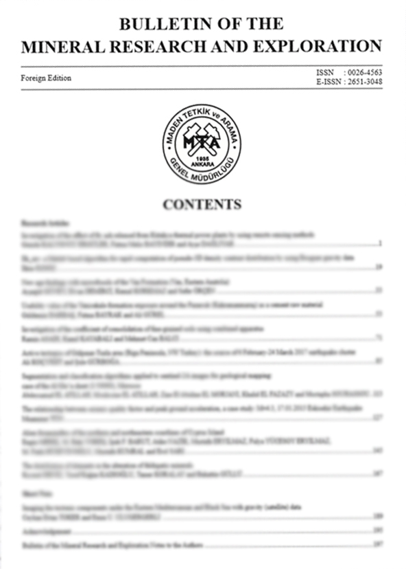
Volume 170 · April 2023 · 10 ARTICLES
All Articles In This Issue
01
Indexed In · Volume 170 / April 2023
Magnetic anisotropy of a sub-ophiolitic metamorphic sole (Mersin ophiolite, Türkiye)
Authors: ABSTRACTThe Mersin ophiolite of southern Turkey is a well-exposed, Late Cretaceous, Neo-Tethyan suprasubduction
zone ophiolite. It is underlain by metamorphic sole rocks inferred to have formed at the top of a down-going plate during subduction. These have a well-developed foliation and lineation observable in the field (defined by the preferred orientations of hornblende and plagioclase crystals). Here we present the first magnetic fabric data reported from the Mersin ophiolite with such settings. Anisotropy of low field magnetic susceptibility ellipsoids in sampled amphibolites have clustered, NW-plunging minimum principal axes representing poles to a SE-dipping magnetic foliation that aligns with the macroscopic metamorphic foliation plane seen in the field. Maximum AMS principal axes define a SE-plunging magnetic lineation that is parallel to the macroscopic metamorphic lineation. Oblate magnetic fabrics at specimen-level and an overall triaxial fabric at locality-level in these rocks are consistent with the development of the dominant metamorphic fabric by a combination of pure shear flattening and simple shearing during the formation and exhumation of the Mersin sole rocks. These observations are compatible with a recent tectonic model for the evolution of the ophiolite based on paleomagnetic data that invokes flattening and exhumation of the down-going slab in an incipient subduction zone during supra-subduction zone spreading.
Keywords:
02
Indexed In · Volume 170 / April 2023
Paleoecological investigation of the Miocene (23.03-5.33 mya) rodents (Mammalia: Rodentia) in Anatolia
Authors: ABSTRACTAnatolia’s geographical location as a land bridge between Europe, Asia, and Africa, makes it an important passage for mammal migrations, with a rich fossil potential. However, detailed scientific studies on the Neogene paleogeography of Anatolia are scarce. Rodentia is among the major mammal groups generally adapting to different habitat types and rapidly evolving with the changing geography. Investigating this group provides data to increase the accuracy of ecological analyses. We selected Rodentia fossils from the Miocene excavation sites with published papers, and examined specimens of 14 families from 106 localities. Cricetidae, Muridae, Gliridae, and Sciuridae were found to be most dominant rodent families in Anatolia during the Early Miocene, indicating a high humidity, whereas ecological changes towards the end of this epoch led to a complex formation in the biogeography of micromammals. In the Middle Miocene, a 65% decrease in Muridae, the emergence of Eomyidae, and a significant increase in Spalacidae suggest a climate shift, towards tropical or semi-tropical conditions. In the Late Miocene, Muridae regaining its maximum level and becoming the most crowded family may indicate an unexpected rise in humidity, while the stable prevalence of Eomyidae and Castoridae point to the continuity of aquatic environments and humidity.
Keywords:
03
Indexed In · Volume 170 / April 2023
GIS-based analytical hierarchy process, weight of evidence and logistic regression models for the landslide susceptibility predicting in Echorfa Region (northwestern of Algeria)
Authors: ABSTRACTThe main objective of this study is destined to combine the Analytical Hierarchy Process (AHP), Weight of Evidence (WOE), Logistic Regression (LR) methods and geographic information system (GIS) to predict landslide susceptibility of the Echorfa region (northwestern of Algeria). Nine factors such as slope, aspect, lithology, distance to faults, lineaments density, distance to the streams, precipitations, land use and altitude are included in landslide susceptibility evaluation process. A detailed landslide inventory map was established by satellite images and filed surveys. Three landslide susceptibility maps are established using the different statistical models. Five landslide susceptibility categories are generated by the GSI classification nil, low, moderate, high and very high susceptibility. The performance of the different models in landslide susceptibility is calculated based in the area under curve of the Receiver Operating Characteristic (ROC) which give a satisfactory result. The results showed that the WOE is more performance than the two other techniques. The produced landslide susceptibility maps provide important spatial information about landslide prone area, where the constructed map’s content will help the decision makers in land use planning.
Keywords:
04
Indexed In · Volume 170 / April 2023
Stratigraphy of the metamorphic rocks of Niğde Massif and new evidence of Triassic rifting of the Inner Tauride Ocean (Central Anatolia, Türkiye)
Authors: ABSTRACTMetamorphites of Niğde Massif, which form the basis of the study area covering the Niğde vicinity in Central Anatolia, are composed of Late Devonian Gümüşler, Carboniferous-early Permian Kaleboynu late Permian Kızıldağ formation and unconformable Triassic-Late Cretaceous cover units from bottom to the top, which are separated from each other with unconformities. The Triassic succession (Söğütlüdere formation) of phyllite-marble-schist alternations with common amphibolite levels is first distinguished in this study, unconformably overlies the Paleozoic succession. Thick homogeneous marbles of Jurassic-Cretaceous period, is defined by quartzite at the bottom representing the unconformity at the base, is defined as the Kırtepe formation. The succession probably ends with the Late Cretaceous metaflysch (Kırkpınar formation) constituting metaophiolite blocks with unconformable contact relationships. Amphibolite sample of the Söğütlüdere formation gives 239 Ma (Middle Triassic) age, which is interpreted as the crystallization age of the primary basic magmatism. The youngest detrital zircon ages (223-224 Ma) obtained from the metaclastics of the same formation shows that the primary deposition age of the formation is probably Late Triassic, which is consistent with this data. Geochemical data indicate an extensional environment of the alkaline composition and anorogenic originated basic volcanism developed on the continental crust. When these results evaluated together with the regional data, the metabasites of the Söğütlüdere formation can be interpreted as the first phase products of rifting, which commenced with the rifting process of the Tauride-Anatolide Platform in the Triassic period and resulted in the opening of the Inner Tauride Ocean and the break off the Kırşehir Block.
Keywords:
05
Indexed In · Volume 170 / April 2023
Production of rare-earth oxides from Eskişehir-Beylikova complex ores
Authors: ABSTRACTIn this study, the production technology of barite, fluorite, rare-earth elements, and thorium-bearing rare-earth oxides from the Eskişehir-Beylikova were investigated, and the processes that can be used in the production of thorium-free mixed rare earth oxides were tested. The applied processes are roasting, leaching, solvent extraction and precipitation methods, respectively. After all studies, the optimum roasting temperature and roasting duration are determined as 600 °C and 1 hour. In the extraction stage, the highest leaching efficiency is achieved with 5 M HCl, 1-hour leaching duration, 1/3 solid/liquid ratio and 35 °C leaching temperature. While methyl tri C8-C10 ammonium chloride (Adogen 464) is used for the removal of iron from produced solution, di-(2-ethylhexyl) phosphoric acid (D2EHPA) is used for the removal of thorium. As a result of solvent extraction studies, the solution containing rare earth elements is precipitated under optimum conditions. After precipitation, the product contains 99.65% rare earth oxides.
Keywords:
06
Indexed In · Volume 170 / April 2023
Evaluation of recent earthquake activity along the Ganos Fault: MONGAN network test analysis
Authors: ABSTRACTThe Monitoring of the Ganos Fault data presents significant opportunities and challenges for earthquake detection, location and magnitude calculations, source mechanism solutions, and discovery of fault zone waves. This study indicates mostly of preliminary data analysis and seismological evaluations. While narrow distance aperture installation has an opportunity to detect microearthquakes, it also causes significant difficulties in determining the source parameters of micro-earthquakes. Extracting microearthquakes from continuous data shows that special strategies need to be used. MONGAN data revealed the presence of many earthquakes with magnitude M
Keywords:
07
Indexed In · Volume 170 / April 2023
A new look at the origin of N-S trending young basins of western Anatolia
Authors: ABSTRACTIn the western Anatolia, the tectonic regime transitioned from crustal shortening to extension during Late Cenozoic time and evidence of this event was imprinted on basement lithologies and N-S and E-W oriented two distinct basin sub-types. Here, we examined the exhumation mechanism of the Menderes massif that forms the basement of these basins from a different perspective. The N-S oriented basins overlying different basement rock types were re-evaluated based on new evidence that has potential to put new constrains for interpreting the tectonic evolution of the area. Unroofing of the Menderes Massif must have developed due to compressional core complex. Per the model generated from our observations, we propose that the western Anatolia underwent a N-S contraction during the Early-Middle Miocene time. In this period from Marmara Sea at north to Mediterranean Sea at south, numerous basins, as in Gördes and Demirci, were bound by N-S oriented oblique faults. Evidence of contraction in the region during Early Middle Miocene time is understood by N-S oriented obique, strike-slip faults, folds, and reverse faults. Starting from the Plio-Quaternary time, the contractional regime was shifted to extension and ensuing E-W oriented grabens were formed in Gediz, Büyük Menderes, and Gökova. The structural deformation associated with these E-W oriented grabens are normal faults and related open folds. Geological evidence of multigeneration extension is recognized in the basins and basin-filling deposits throughout the Neogene to Quaternary time.
Keywords:
08
Indexed In · Volume 170 / April 2023
The importance of Confocal Raman Spectroscopy and mineral chemistry studies in the magma crystallization processes: Strandja Intrusives, NW Türkiye
Authors: ABSTRACTThe Strandja Massif cropping out in NW Turkey is cut by Late Cretaceous intrusives. These are called Strandja Intrusives and they are felsic and mafic coeval intrusives. Felsic intrusives consist of granite, granodiorite, quartz monzonite and syenite, while mafic intrusives consist of diorite and gabbro composition. Main composition of felsic intrusives consists of quartz, alkali feldspar, plagioclase, biotite, amphibole ±pyroxene mineral association, while main composition of mafic ones consists of plagioclase, biotite, amphibole ±pyroxene ±olivine mineral association. Amphiboles hydrated double-chain mineral of the Strandja Intrusives observed in all rocks used as an index mineral in this study to understand the petrological evolution of the rocks. According to Confocal Raman Spectroscopy studies amphiboles were actinolite type and exhibited similar spectrum and results of mineral chemistry reveals that they were calcic/Mg-hornblende types. According to geothermobarometer calculations, amphiboles crystallize in felsic intrusives at a pressure range of 0.49-0.94 kbar and a temperature of 757.52-814.49oC temperature at a depth of approximately 1.34-4.93 km, while in mafic ones at 2.59 kbar pressure and 892.82oC temperature at 9.97 km depth. Different temperatures-depth conditions and overlaps in Raman shift obtained from amphiboles indicate that these intrusives are derived from different sources but crystallized in the same environment.
Keywords:
09
Indexed In · Volume 170 / April 2023
Evaporate salt exploration by two dimensional (2D) seismic reflection method: Ankara- Polatlı region, Türkiye
Authors: ABSTRACTThe presence of the evaporate salt zone in Ankara-Polatlı region has been determined by the drillings. It is thought to be the largest reserve in Türkiye. The seismic reflection method was used to determine the top-bottom levels of the zone; its depth; its thickness and extent boundaries; the horstgraben structures; base depth and tectonic movements affecting the study area. Data were collected on three seismic lines. The near-surface tomographic velocity sections were compatible with the top-of-the-zone depth observed in the drillings. As a result of the study, the depth and thickness of the top-bottom of the zone were determined along the lines. Within the scope of the study, a combined interpretation was made on the lines by using gravity and seismic data. The extent of the ore zone was determined only in the E-W direction section, but not in the north-south direction lines since they are outside the license area and the seismic lines. The closest point of the evaporate zone to the surface is approximately 150 m, the deepest point is approximately 310 m, the average thickness is
approximately 100 m and the maximum thickness is 185 m.
Keywords:
10
Indexed In · Volume 170 / April 2023
Determination of the coal-bearing zones and the alteration zones containing uranium ore by using two dimensional (2D) seismic reflection method in Thrace Basin
Authors: ABSTRACTIt is aimed to reveal the basement topography, the coal-bearing levels, the alteration zones containing uranium ore, and the tectonic structure prevailing by using two dimensional (2D) seismic reflection method in the Thrace Paleogene-Neogene Basin. In this context, seismic data collected on the six profiles were interpreted by correlating with the data of 97 wells. In the seismic lines, respectively, the metamorphic basement-Eocene boundary, the top of the coal-bearing zone and the boundary of the Danişmen-Ergene formations were confirmed by using the borehole data. By evaluating seismic data, the coal propagation is modeled with three dimensional (3D) figures. Moreover, coal accumulation starts from the southwest of the field and continues towards the northeast, and it is supported by the results obtained from the borehole data. The presence of uranium ore in some of the alteration zones and borehole data indicated that all alteration zones determined should be inspected for uranium ore. In addition to normal and reverse faults, positive and negative flower structures formed in the strike-slip fault zones were determined, and lignite deposits were cut in the flank of these structures. Finally, it is recommended to carry out seismic studies before drilling, to investigate potential coal and uranium areas and to plan more seismic lines.
Keywords:
No articles match your search.