

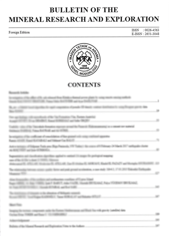
Volume 166 · 2021 · 11 ARTICLES
All Articles In This Issue
01
Indexed In · Volume 166 / 2021
Investigation of the effect of fly ash released from Kütahya thermal power plants by using remote sensing methods
Authors: ABSTRACTIn order to determine the long-term effect of thermal power plants, the satellite images of Seyitömer and Tunçbilek Thermal Power Plants and their vicinities were analyzed by using the software of ERDAS IMAGINE v9.1 and PCI Geomatica 2017. The normalized difference vegetation index (NDVI) was determined by using red and near-infrared bands of Landsat satellite images, and areas containing vegetation were revealed in the images. In order to obtain the temporal change in the vegetation areas, the relevant image change detection analysis was applied and the one-year and thirty-year temporal change of vegetation cover is for r = 4 km, r = 12 km, r = 50 km. In the remote
sensing mapping studies, it was determined that as the diameter of the assessment area increases, the dominant wind loses its effect, and geomorphological conditions are more prominent.
https://doi.org/10.19111/bulletinofmre.946782
Keywords:
02
Indexed In · Volume 166 / 2021
Ilk_inv: a Matlab based algorithm for rapid computation of pseudo-3D density contrast distribution by using Bouguer gravity data
Authors: ABSTRACTThe new generation Matlab-based algorithm provides a rapid estimation of density contrast distribution. The 3D assumption, which is based on the 1D equation, is used. Therefore, the output is called pseudo-3D instead of 3D. The algorithm uses singular value decomposition and the median filter to produce pseudo-3D results. The success of the method is tested by theoretical and field studies. For synthetic studies, single-source models produce reasonable outputs, compared to the true density contrast value. However, the multiple source model shows slight deviations which are ±0.3 g/cm3, with respect to the true density contrast value. The acceptable results are observed for the Bouguer anomaly of the eastern Mediterranean region. The resolution matrix indicates that the inversion process is biased due to the generalised inverse. The algorithm provides a quite different qualitative interpretation perspective to the interpreter..
https://doi.org/10.19111/bulletinofmre.959011
Keywords:
03
Indexed In · Volume 166 / 2021
New age findings with microfossils of the Van Formation (Van, Eastern Anatolia)
Authors: ABSTRACTVan Formation, which is mainly represented by conglomerate, sandstone, marl and limestone, covers a large area around the Van province. The age of the unit was assigned in different localities of the region as late Oligocene - middle Miocene, early Miocene, Burdigalian - Langhian (early - middle Miocene) by previous studies. In order to determine the age of the upper levels of the formation in the east and southeast of Lake Van, a total of 98 samples collected from three measured stratigraphic sections. These samples have been examined in terms of calcareous nannoplankton and planktonic foraminiferal content. 33 species of 12 calcareous nannoplankton genera and 18 species of 9 planktonic foraminiferal genera representing the Serravalian - Tortonian interval have been identified. Calcareous nannoplankton and planktonic foraminiferal biozones of the unit could not be defined in the study area because of some samples do not contain calcareous nannoplankton and planktonic foraminifera, some samples are scarce in fossils and not all of the zonal markers have been identified. Considering the stratigraphic distribution of the calcareous nannoplankton and planktonic foraminiferal species that the formation contains, age of the Van Formation in the study area is re-evaluated as Serravallian - Tortonian (middle - late Miocene). This shows that marine features continued in the Tortonian (late Miocene) in the study area.
https://doi.org/10.19111/bulletinofmre.897859
Keywords:
04
Indexed In · Volume 166 / 2021
Usability value of the Yenicekale formation exposure around the Pazarcık (Kahramanmaraş) as a cement raw material
Authors: ABSTRACTThe study area is located around Pazarcık - Narlı, Kahramanmaraş province. The aim of the study is to investigate the value of units belonging to the Yenicekale Formation Kışla Marl Member as cement raw material. As a result of XRD studies, it was determined that Yenicekale formation Kışla Marn Member which is exposed to large areas in the region is composed of illite, quartz, dolomite, calcite, and chlorite minerals by rock analyzed. By geochemical analysis, SiO2, Al2O3, Fe2O3, CaO, MgO, K2O, Na2O, SO3 contents of the units were determined and these values were compared with the limit values used in cement raw materials. When the results were evaluated, it was determined that the total alkali elements (Na2O+ K2O) were within the limit values, but others were below or above these limit values. In addition, with geochemical analyses, it was calculated Silicate and Aluminium Modules. The most suitable values for Silicate Modules in Turkish Cement Factories are 2.2 - 2.6. In this study, Silicate Modulus values are in the range of 1.94 - 5.22. Standard values or Aluminum are between 1.5 and 2.5. The values of Aluminum Modules determined in this study are in the range of 0.43 - 1.38. For Hydraulic Module, the standard values are in the range of 1.8 - 2.2. The values determined in this study are in the range of 0.24 - 5.
https://doi.org/10.19111/bulletinofmre.856536
Keywords:
05
Indexed In · Volume 166 / 2021
Investigation of the coefficient of consolidation of fine-grained soils using combined apparatus
Authors: ABSTRACTThe scope of this investigation is to compare the coefficient of consolidation (cv) values defined by the Taylor’s Square Root of Time Fitting Method, which is obtained from the conventional oedometer tests, with the cv values calculated by Terzaghi’s One Dimensional (1D) Consolidation Theory, which is obtained from the permeability-consolidation tests performed with a combined apparatus specifically designed for this study. In addition, an empirical relation is developed to determine cv using the coefficient of permeability (k) and index properties of the soils. The cv values obtained from the permeability-consolidation tests using the combined apparatus were found to be larger than the cv values defined by the Taylor’s method, which is one of the oedometer tests. The findings showed that the difference was more prominent in the soil samples with a high plasticity. It was also found that the cv calculated by the Taylor’s method exhibited a distribution in a wide range with the increased load depending on the degree of plasticity of the soil. The cv obtained from the combined apparatus it decreased with low load values and increased with higher load levels. The cv obtained by the proposed empirical relationship showed good agreement with the cv defined by permeabilityconsolidation relationships.
https://doi.org/10.19111/bulletinofmre.835936
Keywords:
06
Indexed In · Volume 166 / 2021
Active tectonics of Gülpınar-Tuzla area (Biga Peninsula, NW Turkey): the source of 6 February-24 March 2017 earthquake cluster
Authors: ABSTRACTThe variation in the motion sense of Anatolian platelet in Aegean Sea resulted in a strike-slip tectonic regime and related neotectonic domain, the central to northern Aegean neotectonic province, which also includes both western Marmara Sea and Biga Peninsula. Our study focuses mostly on the Gülpınar-Tuzla earthquake area located at the southwestern tip of Biga Peninsula,which is controlled by the southern major strand of the North Anatolian Fault System (NAFS). The strand consists of two sections, the onshore Biga and offshore Babakale-Skyros sections. Both sections are seismically very active. The Gülpınar-Tuzla earthquake area is composed of the Paleozoic metamorphic rocks, the Oligo-Miocene granitoid pluton, Lower-Middle Miocene calcalkalic volcanic rocks and the Upper Miocene-Pliocene sedimentary sequence. All of these rocks, which formed and deformed (folded to tilted) in palaeotectonic period, are overlain with an angular unconformity by the Quaternary neotectonic basin fill, that is nearly flat-lying except for the faulted basin margins. Both the onshore and offshore sections of the southern strand are linked to each other in terms of the structures characterizing the Babakale pull-apart basin and the Gülpınar-Tuzla earthquake area. The latter is shaped by the NE-trending Gülpınar (GFZ) and Yenice-Gönen Fault Zone (YGFZ), the ENE-trending Edremit fault zone (EFZ), the WNW-trending Tuzla Fault Zone (TFZ) and three strike-slip basins (Ayvacık, Behramkale and Tuzla basins) developed along them. Some segments of both the TFZ and GFZ were reactivated by the occurrences of seven moderate-to small-sized independent earthquakes and related aftershocks over 2760. Five of the independent earthquakes have an origin of oblique-slip normal faulting, while the rest two seismic events are strike-slip faulting in origin. Focal mechanism solution diagrams of these two groups of earthquakes reveal that the Gülpınar-Tuzla area is under the control of a strike-slip neotectonic regime, which commenced in Early Quaternary time owing to the major inversion in extensional palaeotectonic regime. This is also supported by the palaeostress analysis of slip-plane data measured on fault slickensides. The uniform slip rates on both the YGFZ and EFZ are 10.8 mm/yr and 7.3 mm/yr, respectively.
https://doi.org/10.19111/bulletinofmre.984922
Keywords:
07
Indexed In · Volume 166 / 2021
Segmentation and classification algorithms applied to sentinel-2A images for geological mapping: case of the Al Glo’a sheet (1/50000), Morocco
Authors: ABSTRACTThe multispectral image, of Landsat 7 and 8; Aster and Sentinel-2A, has good results in lithological, structural, hydrothermal and mineralogical alteration mapping. Segmentation and image classification are two complementary steps as they are allowed the most important operations in the field of image processing. In this sense, this work aims at evaluating the potential of segmentation and classification algorithms for the generation of surface geological maps, hydrothermal alterations and lineaments. Given the good resolution of the Sentinel 2A (10m), the three images, (11/12; 11/2; 11/8), 12.8.2, main component 1, 2 and 3 (11.12.2), processed by five algorithms (K-means, Isodata, watershed, efficient graph-based image segmentation, thresholding) for geological mapping and then mining exploration. The study displayed that 1) Watershed algorithm can be used for topographic and hydraulic studies, it can be very useful in the preparation phase of geological and mining infrastructures; 2) threshold segmentation does not give good results in terms of geological discrimination since it divides each image into two parts; 3) the same thing for the effective thresholding and segmentation of graph-based images; 4) The Isodata and K-means algorithms show good geological discrimination.
https://doi.org/10.19111/bulletinofmre.864492
Keywords:
08
Indexed In · Volume 166 / 2021
The relationship between seismic quality factor and peak ground acceleration, a case study: M=4.3, 17.01.2015 Eskişehir Earthquake
Authors: ABSTRACTSeismic wave propagation in subsurface media endures from absorption, which can be evaluated by the seismic quality factor Q (Q-factor). Absorption is frequency-dependent. Lower frequencies are absorbed less, while higher frequencies are absorbed more. Therefore, the Q Factor should be determined in the frequency domain. Q-factor is determined by the slope of the natural logarithm of the output-input signals ratio. Surface waves (Rayleigh and Love waves) are particularly important, as they are the more destructive phases of an earthquake. This study was, focused on the Q-factor computation of the surface waves and demonstrated that the determination of the Q-factor is not affected from the dispersive properties of the surface waves. Data were obtained from surface wave signals of earthquake recorded at Eskişehir Technical University Seismic Network - EstuNet. The obtained Q-factor values represent the average values of the rocks that the waves cross between the input and output stations. Finally, the Q-factor map to the Peak Ground Acceleration (PGA) map using the M=4.3, 17.01.2015 Eskişehir earthquake data was compared. These records show the arrival time of the earthquake from the epicenter to the stations of the seismic waves, and the peak ground acceleration values. In this study, local site effects of EstuNet accelerometric stations have been calculated by using the Standard Spectral Ratio (SSR) method. It is concluded that an inverse relationship exists between the computed Q-factor and measured PGA values. Therefore, the sites where the Q factor is very low should be analyzed in more detail in ground-based earthquake risk assessments.
https://doi.org/10.19111/bulletinofmre.841785
Keywords:
09
Indexed In · Volume 166 / 2021
Alien foraminifers of the northern and northeastern coastlines of Cyprus Island
Authors: ABSTRACTThe study area covers the northern coasts of Cyprus from the Güzelyurt Gulf to the Gazimağusa Gulf. This study was carried out in order to reveal the presence of the alien foraminifera, which are widely distributed in the Eastern Mediterranean particularly Amphistegina lobifera in the study area, and the effects of trace elements on faunal assemblages (foraminifera, ostracod and mollusc). The bottom sediment samples were taken from eighteen different points and depths, the faunal assemblages were examined, and the sediment distribution map of the studied area was made by ICP-MS analysis and geochemical evaluations. 30 genera and 48 species of foraminifera have been identified, of which 9 species belonging to 6 genera are the alien foraminifera. These are: Spiroloculina angulosa, S. antillarum, Hauerina diversa, Coscinospira hemprichii, Peneroplis pertusus, P. planatus, Amphisorus hemprichii, Sorites orbiculus and Amphistegina lobifera. Amphistegina lobifera was observed to be abnormally abundant in most of the samples. This foraminiferal assemblage of Red Sea origin constitutes a poor assemblage compared to the alien assemblages in Turkish Mediterranean coastal areas. It has been determined that the ostracod and mollusc genera and species found in the same samples belong to the typical Mediterranean and Aegean Sea community.
https://doi.org/10.19111/bulletinofmre.838609
Keywords:
10
Indexed In · Volume 166 / 2021
The distribution of elements in the alteration of feldspatic minerals
Authors: ABSTRACTFeldspar (alkali feldspar and plagioclases) and in recent years feldspathoid minerals are used as raw materials in the ceramic-glass industries. The igneous rocks such as granite, syenite and foid syenite which mainly contain these minerals have the potential to be raw materials. Some inclusions within the feldspatic minerals affect extremely negatively the desired values for raw material. In this study, the effective processes in the alteration of feldspatic minerals within the Özvatan foid syenites, the effects of alteration minerals in the raw material were evaluated and the effects of the elements released by alteration on the environment were revealed. The foid syenites consist of nepheline, orthoclase, plagioclase, cancrinite, sodalite, amphibole, biotite, pyroxene, melanite with a rare amount of sphene, zircon, apatite and fluorite. The contents of the sericite and kaolinite, which are formed as a result of an alteration of these rocks, increase in direct proportion to alteration degree. As a result of the alteration index values, foid syenites samples show the low degreed decomposed property. According to the calculated mobility index (MI) from chemical analyses, there is a quantitative decrease in the major oxides such as SiO2, Al2O3, Na2O, K2O, CaO and Fe2O3 in the foid syenites. In accordance with the all data, Özvatan foid syenites have been exposed both weathering and hydrothermal alteration and the effect of hydrothermal alteration are observed more frequently in the altered rock. While the excess of diaclase structures within the rock provides ease of operation, on the other hand, it accelerated the weathering and alteration processes.
https://doi.org/10.19111/bulletinofmre.901035
Keywords:
11
Indexed In · Volume 166 / 2021
Imaging the tectonic components under the Eastern Mediterranean and Black Sea with gravity (satellite) data
Authors: ABSTRACTTectonic structures in the Black Sea and the Levantine Sea were mapped using satellite gravity data. The relationship between Antalya and Cyprus arcs is revealed by the deformation traces of the arc formation. The Cyprus arc which over the slice that disappears from the South of the Anaximander seamounts to the Northeast, can traceable at the western end of the Antalya Bay. The distinction of western and eastern basins in the Black Sea is also mapped. Due to the low spatial resolution, additional studies with higher resolution are required.
https://doi.org/10.19111/bulletinofmre.975929
Keywords:
No articles match your search.