

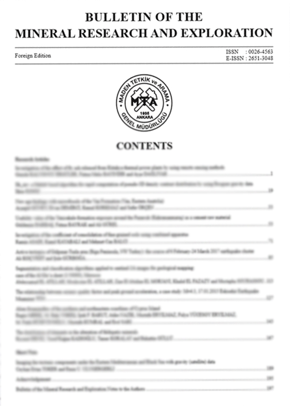
Volume 163 · 2020 · 13 ARTICLES
All Articles In This Issue
01
Indexed In · Volume 163 / 2020
First Turolian findings in the Neogene sequence of Denizli Basin (SW Anatolia) and its regional palaeobiogeographic significance
Authors: ABSTRACTThe large fossil vertebrates obtained from the alluvial flood-plain deposits of the Kolankaya formation are determined as Skoufotragus laticeps (Andree, 1926) and Hipparion brachypus (Hensel, 1862), as representative elements of palaeomammal faunas spanning from the eastern Mediterranean to Iranian domains during the late Miocene (early-middle Turolian, MN11-12). These first Turolian records from the basin fill succession bear importance on reconstruction for the palaeobiogeographic diversity of relevant taxons as well as admit of interbasinal stratigraphic correlation for the Western Anatolian terrestrial Neogene basins.
https://doi.org/10.19111/bulletinofmre.651620
Keywords:
02
Indexed In · Volume 163 / 2020
Tectonic meaning of the deformation in shallow marine region between Gaziköy-Mürefte (Sea of Marmara) by using seismic reflection data, NW Anatolia
Authors: ABSTRACTWithin the scope of this paper, seismic reflection and bathymetry studies were carried out in the shallow marine area forming the westernmost part of the Tekirdağ Basin using the R/V Selen Research Vessel within the MTA Marine Research Department. In the study area, ~ 500 km length bathymetry data and ~191 km shallow seismic profiles ( 41 lines) were collected. By means of the data, tectonic structures and deformation textures of the North Anatolian Fault System (NAFS) in the marine area of Gaziköy were examined. As a result of the processing and interpretation of the seismic sections, compression structures occurring due to the SW rotation of the NAFS in the study area, the morphology of the Ganos depression that formed as a result of faulting and also three different stratigraphic units were distinguished. These units are separated from each other by distinct unconformity surfaces and each unit presents different deformation structures. One of the most significant results obtained from the seismic data is that the unconformity surface that separates the current sediments of the seafloor from the older units is represented by the overlapping structures indicate sea level changes. It has been assessed that this situation occurred as a result of the erosional process developed during sea level fall.
https://doi.org/10.19111/bulletinofmre.784476
Keywords:
03
Indexed In · Volume 163 / 2020
Using of GIS on field geology studies: An application on central-southern of Eskişehir
Authors: ABSTRACTTechnological developments on Geographical Information Systems (GIS) make possible to use its applications on all departments of earth sciences. GIS based drill-hole data, lithological and structural maps are used integrated with field geolgy investigations in this study. The area where is bordered Batıkent-Yukarı Söğütönü districts on northwest and Vadişehir-Ihlamurkent districts on southeast is defined as study area. 44 water wells drilled by State Hydraulic Works (DSİ) are located in various points of Eskişehir region were transformed to GIS base. Geological cross-sections which were designed by drill-hole lithology are point out a disconformity zones between Paleogene and Neogene according to principle of lateral continuity. Neotechtonic researches on study area Show thah right lateral strike slip shear zone dominates the region structurally. Searching these structural traces on the field and representing new field evidances by using GIS on the regions where there is no consensus stratigraphicly are the main purposes of the study. Geological map of the region where lies between Çankaya and Karapınar districts without consensus stratigrapichly was made by field observations on Miocene units. The other surface evidances include dilation fractures, strike-slip faults are support the idea which is suggested for Eskişehir region as right lateral strike-slip shear zone.
https://doi.org//10.19111/bulletinofmre.669305
Keywords:
04
Indexed In · Volume 163 / 2020
2D and 3D structural boundaries of the tectonic composition of the Anatolia and surrounding seas using by the gravity (Satellite Data): Eastern Mediterranean
Authors: ABSTRACTGravity data is processed and the problems of the earth are examined. The density of the data can be arranged to solve detail, semi-detail and regional problems. Here, the gravitational data obtained by processing the linearity of the 2D and 3D visuals in terms of plate size large wavelength structures are examined. 2D linearities determine important stress areas but they are affected at different rates with respect to the spatial distribution of source effect. Due to grid formation, these boundaries are affected at different rates from less dense and very dense structures. Different wavelengths in structure boundary analysis; derivative and phase elements and filters. Vertical change in 3D analysis can be made at the approach level with the analytical examination of 2D change. At this stage, the distribution of source effect and depth model structure parameters are calculated. When examining large wavelength structures, some of the buried structures appear due to cover removal. In search of solutions for tectonic structures that we may miss; The tectonic components that need to be confirmed in the Eastern Mediterranean have been tried to be elucidated in this study. 3D building solutions are important in this respect.
https://doi.org//10.19111/bulletinofmre.641237
Keywords:
05
Indexed In · Volume 163 / 2020
Oligocene molasse sedimentation in the Central Taurides: Records of the onset of extensional tectonic regime
Authors: ABSTRACTThe lacustrine units have been deposited in the Ermenek, Bucakkışla, Korucuk and Çamlıyayla basins in the Central Taurides since early Oligocene. In this study, structural features and stratigraphical properties of Oligocene basins have been described in detail and the lacustrine units have been dated. Regional geological interpretations have been made by using tectono-stratigraphic and age data of the basins. Lacustrine Oligocene sedimentation in these basins, which were opened on the tectonic units of Taurides due to normal faults, constitute the first records of the sedimentation occurring under the extensional tectonic regime after the orogeny of the Central Taurides. All the pre-Oligocene units that had been emplaced in the region due to a north-south compressional movement in the Central Taurides, continued to be compressed until the end of Eocene, and completed their orogenic development as napped structures. The bedrock units, reaching the maximum elevation, have been subjected to “orogenic collapse” due to the strain or gravity forces as a result of an interruption or termination of the compression which lasted until the end of Eocene. Thus, “orogenic collapse” basins have started to be formed in the Central Taurides since Oligocene. The orogeny and the compressional tectonic regime forming the Taurides lasted until late Miocene in the Eastern Taurides. On the other hand, extensional basin formation since early Oligocene on the Taurus units, which had been emplaced in the region due to nappe tectonics, indicates that a new tectonic period has started in the Central Taurides.
https://doi.org/10.19111/bulletinofmre.681218
Keywords:
06
Indexed In · Volume 163 / 2020
The internal structure of Beypazarı Blind Thrust Zone around Çayırhan
Authors: ABSTRACTThe Beypazarı Blind Thrust Zone, which is surrounded by the North Anatolian, the Eskişehir, and the Kırıkkale-Erbaa fault zones, is a recently defined neotectonic structure developed in the NW central Anatolia together with the Eldivan-Elmadağ and the Abdüsselam Pinched Crustal Wedges. In this study, the internal structure of the Beypazarı Blind Thrust Zone has been examined in detail around Çayırhan region. It has been defined that it consists of the Karaköy, Sekli, Nalçabayırı, Uzunbayır blind thrusts, Davutoğlan Back Thrust, and Beypazarı Blind Thrust I-II from North to south, respectively with help of the fault-propagation folds in the study area. The existence of economically important and operational resources such as lignite and trona in the Neogene sequence affected by these faults in the region and earthquake generating potential of the faults determined in previous studies increase the importance of this study.
https://doi.org/10.19111/bulletinofmre.651712
Keywords:
07
Indexed In · Volume 163 / 2020
An approach for the application of energy-based liquefaction procedure using field case history data
Authors: ABSTRACTThis paper presents an overview to the applicability of the “energy-based liquefaction approach” with regards to the new developments in the subject. The method involves comparing the strain energy for the soil liquefaction (capacity) with the strain energy imparted to the soil layer during an earthquake (demand). The performance of the method was evaluated by using a large database of SPT-based liquefaction case history. The energy-based method and the more commonly used stressbased method were compared in their capability to assess liquefaction potential under the same damaging historic earthquakes and geotechnical site conditions. In the procedure, the predictive strain energy equations were used to estimate the capacity energy values. These empirical equations have been developed based on the initial effective soil parameters. As for the energy of any given strong ground motion, it was computed from a velocity-time history of the ground motion and the unit mass of soil through utilization of kinetic energy concepts. The proposed energy-based method has effective way in evaluating the liquefaction potential based on the seismological parameters, contrary to the stress-based approach, where only peak ground acceleration (PGA) is considered.
https://doi.org/10.19111/bulletinofmre.677626
Keywords:
08
Indexed In · Volume 163 / 2020
Integration of the GNSS method and borehole camera to model the resulting spherical cavity generated by the main charge blast in clay
Authors: ABSTRACTA depth camera was used to record the spherical cavity which occurred during blasting in clay soil. For this purpose, the integration of the Global Navigation Satellite System (GNSS) method was applied in addition to the depth camera and the laser, to determine the resulting spherical cavity. The expanded spherical cavity, formed after the blasting of the explosive charge in the bottom of the borehole, was measured by a depth camera-laser system. The GNSS measurement method was instrumental for obtaining the coordinates of the borehole. The Multichannel Analysis of Surface Waves (MASW) measurement method was also used during the study. Shear wave velocities (VS) were calculated using MASW method to evaluate the dynamic properties of the clay soil along the in-situ profiles. The results obtained in this way, showed that there was an increase in the stiffness of the surrounding clay soil after blasting. The main objective of the study was to determine the resulting shapes and volume of the occurred cavities. For a more detailed graphical interpretation, an application was developed, which calculates the coordinates, shape and volumes of the formed spherical cavity.
https://doi.org/10.19111/bulletinofmre.726391
Keywords:
09
Indexed In · Volume 163 / 2020
A laboratory-scale investigation on freezing-thawing behavior of some natural stone samples manifactured in Turkey
Authors: ABSTRACTIn the study, the changes in the mechanical properties of the natural stone samples, which had been obtained from different regions of Turkey, before and after the freeze-thaw test were examined. Within the scope of the study, 17 different natural stone samples were used and, after chemical and mineralogical-petrographical properties were determined. Water absorption at atmospheric pressure, real density, porosity, and uniaxial compressive strength tests were performed before and after freezing-thawing. The freezing and thawing test has been performed using TS EN 12371 standard from -12 °C to +20 °C in 56 cycles (2 cycles = 24 hours). After the test, the samples were subjected to uniaxial compressive strength test in order to identify the changes of the compressive strength values. The results of the physical and mechanical tests on these samples were evaluated by grouping according to chemical and mineralogical-petrographical properties of natural stones. It was aimed to determine which natural stone samples are resistant to freeze-thaw, and can be used in external cladding applications according to the findings obtained from the study.
https://doi.org/10.19111/bulletinofmre.746486
Keywords:
10
Indexed In · Volume 163 / 2020
The relationship of soils developed on different parent materials in Niğde province with lithological units and determination of their suitability for usage agricultural purposes
Authors: ABSTRACTIn this study, general characteristics of soils formed on different parent materials in three different regions of Niğde province, their relationship with lithological units and the extent to which they are suitable for agricultural purposes were determined. Physical and chemical analysis values of rock and soil samples were used to reveal the relationship between lithological units and soils formed in the study area and correlation analysis was applied among the parameters. Multi Criteria Decision Making method was used to determine the suitability of these soils which are formed depending on the parent materials for agricultural use. In order to determine the effect rates among the main criteria of soil, topography, climate and geology and their sub criteria, Analytical Hierarchy Process of Multi Criteria Decision Making method was applied. According to this; Depending on the influence of the lithological units, the soils developed around Bor district are of basic character and the soils developed in Çiftlik and Gölcük districts and their vicinity are more acidic reaction. In addition, it has been determined that the soils of the Çiftlik district and its vicinity are developed by accumulation and in situ, while the soils around Gölcük and Bor districts are developed in situ. In determining the suitability of soils for agricultural use, it was calculated that the main criteria of geology was 5.5% and the criteria of lithological units, which is the sub-criterion of this, was 2.7% effective.
https://doi.org/10.19111/bulletinofmre.742137
Keywords:
11
Indexed In · Volume 163 / 2020
Evolution of slab tearing-related high potassium volcanism: Petrogenetic data from the Emirdağ and İscehisar volcanic units
Authors: ABSTRACTVolcanism that has been active since the early Miocene along a N-S trending line from Eskişehir to Isparta displays calc-alkaline and alkaline character and is closely associated with slab tearing processes. However, the geodynamic setting of these volcanic units between Afyon and Emirdağ is still poorly known. In this study, petrological characteristics of the Emirdağ and İscehisar volcanic units have been investigated using petrography, whole-rock geochemistry and Sr-Nd isotopes. The Emirdağ and İscehisar volcanic units overlap the SeydileIgnimbrites. The Emirdağ volcanic unit is trachyandesite and the İscehisar volcanic unit is trachyte, basaltic trachyandesite and trachydacite in composition. The Emirdağ volcanic unit displays calc-alkaline character, while the İscehisar volcanic unit is alkaline but the rocks from both the units have shoshonite character defined by their high K2O contents. The Emirdağ volcanic unit has 87Sr/86Sr ratios of 0.706790-0.706284 and 143Nd/144Nd ratios of 0.512472-0.512463, while these ratios in the İscehisar volcanic unit are of 0.707650-0.706527 and 0.512464-0.512424, respectively. Data revealed by this study indicate that these volcanic units were affected by crustal contamination, fractional crystallization and magma mixing. Rising of asthenosphere in the region due to the extensional regime in the Early Miocene appears to have caused formation of volcanism that pass from calc-alkaline to alkaline in character. The Emirdağ and İscehisar volcanic units are the products of the volcanism that developed in the late stages of southward slab roll-back and in the extensional regime prior to the slab tearing event.
https://doi.org/10.19111/bulletinofmre.693353
Keywords:
12
Indexed In · Volume 163 / 2020
An overview of the current seismicity of the Sultandağı Fault Zone (Afyonkarahisar-Konya, Western Anatolia)
Authors: ABSTRACTWestern Anatolia is one of the most seismically active regions in Turkey. The high seismic activity is a result of a complex tectonic deformation dominated by the N-S extensional tectonic regime in Western Anatolia. This tectonic deformation is also a result of the relative movement of the African- Arabian plates towards the north, which causes the Anatolian plate to shift 2.5 cm per year towards W-SW. One of the largest fault zones in the Western Anatolia, Sultandağı Fault Zone (SFZ) has a northwest-southeast trend. SFZ, approximately 120 km long, is an important tectonic structure, which produced three major earthquakes (Mw> 6.0) between the years of 2000 -2002. Therefore, the most significant goals of this study were to monitor the micro-earthquakes along SFZ, to enrich the current seismic network and to increase the earthquake detection threshold in the region (Mc
Keywords:
13
Indexed In · Volume 163 / 2020
The electric power production targeted Unconventional Geothermal Systems (UGS), some conceptual designs and their thermodynamics classification
Authors: ABSTRACTThe geothermal energy is a renewable and relatively clean energy resource. The amount of geothermal energy stored just in the upper crust of the earth is large enough to meet the world’s energy needs for thousands of years. Unfortunately, only a small portion of this potential can be utilized today by the conventional methods. The rest corresponds to the hot, fluid-poor areas which cannot be utilized by the current technology. The first concrete steps towards the utilization of such high potential areas emerged in the late 1960s and early 1970s. These studies have gradually continued in the following years, and many new terms and conceptual designs have been proposed so far. Unfortunately, no comprehensive definition has been established on this subject yet. This may bring about some difficulties such as the failure to express the intended concept in the right manner, the inability to determine the legal boundaries for the regulations required by the countries to make use of these areas which pose high risks in the commercial point of view. In this paper, some of the major terms and conceptual designs used for the projects targeting the power generation from fluidpoor hot areas are discussed. Furthermore, all of these terms have been gathered under the title of “Unconventional Geothermal Systems-UGS” and these designs are classified according to the types of thermodynamic system for the first time in this study. In addition, some new suggestions that can be used to define the definitional boundaries of these terms are put forward.
https://doi.org/10.19111/bulletinofmre.660706
Keywords:
No articles match your search.